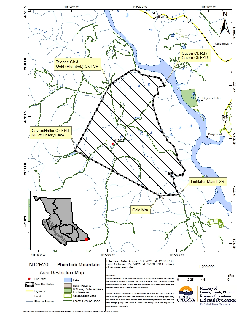
An area restriction has been put in place around the Plumbob Mountain fire, on the west side of Koocanusa Lake.
The fire is estimated to be about 286 hectares in size and is about 18 kilometres west of Baynes Lake.
This means that the public will only be able to enter crown land in the vicinity for specific reasons, such as using the highway, travelling to and from your home, as long it is not under an evacuation order, or if you are helping firefighting efforts.
The area under restrictions stretch from Linklater Main Forest Service Road (FSR) in the south to Teepee Creek and Gold Creek FSR in the north. A detailed map can be found at the end of this article.
Travel along Teepee Creek FSR and Linklater FSR is still allowed, but access to the restricted area from those points is not.
This follows an Evacuation Alert that was issued to 254 properties on the west side of the lake to the Canada/U.S. border and an Evacuation Order to four additional properties.
More: Evacuation Order issued south of Plumbob Mountain (Aug 15, 2021)
More: Evacuation Alert issued for 254 properties from west of Lake Koocanusa to U.S. border (Aug 15, 2021)