Wildfires near Akokli and Redding Creek have prompted an area restriction from the BC Wildfire Service, barring the public from entering the area.
The area restriction means that, as of noon on Wednesday, the public will only be able to enter and exit the vicinity for specific reasons, such as using the highway, travelling to and from your home, as long it is not under an evacuation order, or if you are helping firefighting efforts.
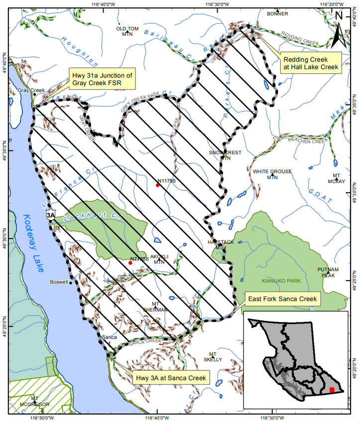
Restricted access stretches from the east shore of Kootenay Lake to the area where Redding Creek meets with Hall Lake Creek. From north to south, it runs from the Highway 31a junction with Gray Creek Forest Service Road (FSR) to Highway 3 at Sanca Creek.
Access along the highway, Gray Creek Pass FSR and Redding Creek FSR will still be open for the time being.
More: 12 new wildfires spark across East Kootenay (July 14, 2021)
The Akokli Creek fire is about 7.5 kilometres northeast of Boswell, while the Redding Creek fire is about 14 northeast of the community. The fires are estimated to be 95 and 100 hectares respectively.
The area with restricted access is detailed in the map below.