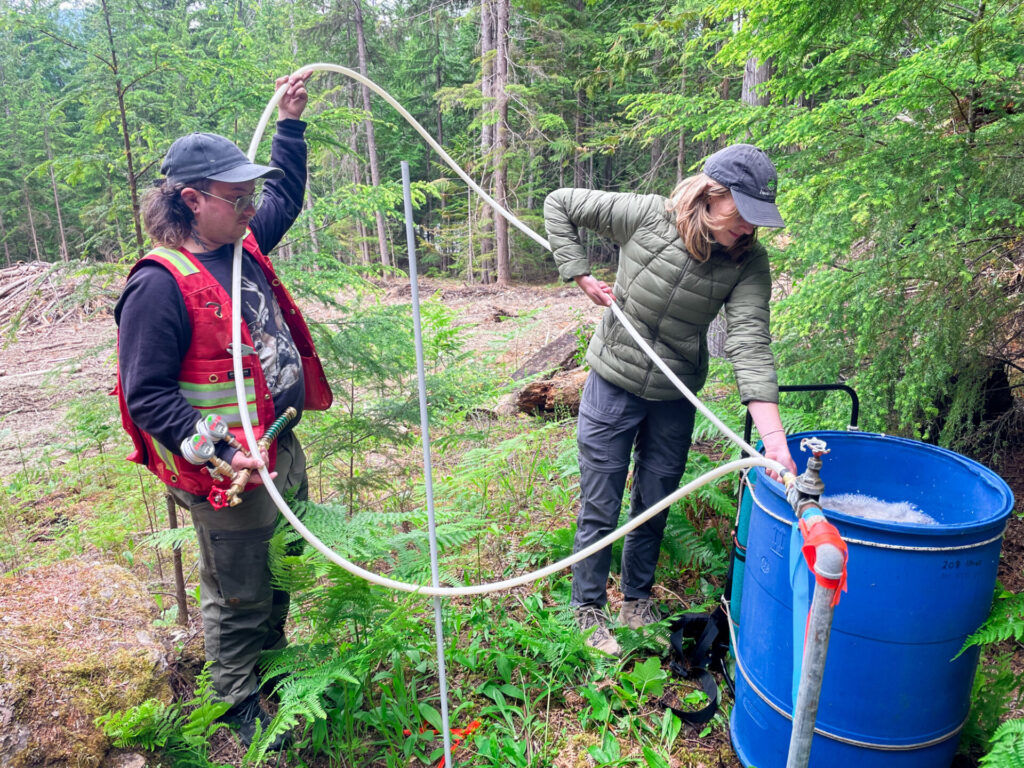
As wildfire seasons grow longer and more destructive, Kootenay communities are turning to water mapping as a proactive solution.
This initiative, led by Living Lakes Canada, is helping communities across the Columbia Basin strengthen their emergency readiness by identifying and documenting critical water sources before wildfires strike.
“The objective of this project is to identify, measure and map the features that can support wildfire crews in responding to a fire.” said Paige Thurston, Wildfire Suppression Program Lead with Living Lakes.
Residents are invited to share their knowledge of creeks, standpipes, hydrants, access routes and other important features, providing on-the-ground information, often missing from existing emergency response systems.
Information about private properties will only be collected with the landowner’s permission.
Argenta in the West Kootenay is an example of water mapping benefits in action.
Living Lakes Canada, working with the Argenta Safety and Preparedness Society, had released their developed maps of water resources in the community one month before the Argenta Creek wildfire broke out in 2024.
“Our maps were used by the B.C. Wildfire Service and the Community Fire Brigade to support their response,” said Thurston.
“Crews reported that these maps cut down on the time needed for field reconnaissance and in the end only one small building was lost in that fire, so, that really showcased how effective this type of tool can be in supporting wildfire response in rural communities and that is what led to the expansion of the project this year.”
Living Lakes Canada is targeting several communities in the Kootenays this season- Winlaw, Red Mountain Road and Enterprise Creek in the west and Grasmere and Yaq̓it ʔa·knuqⱡi’it First Nation in the east.
“Each of these communities were working closely with a local partner and a designated community champion who acts as a liaison between our organization and the community.” said Thurston.
In the Red Mountain Road and Enterprise Creek area, longtime resident Sally Hammond contributed information about springs and creeks on her land.
“I’m pleased to contribute that knowledge to an effort that will benefit our neighbourhood and make the work of firefighters safer and more effective,” she said.
For Michelle Griffiths, Winlaw’s Community Champion and Program Coordinator with the Slocan Integral Forestry Cooperative, the benefits of this project are clear.
“When a wildfire breaks out, there’s no time to search,” she said. “Knowing exact locations of reliable water access points and sources can mean the difference between containment and catastrophe.”
And the sentiments are echoed in the east Kootenay.
“Mapping in advance of a fire event will assist local and external response teams by adding a concise and usable system that will allow them to operate at greater efficiency and speed should an event occur,” said Wade Oestreich, Director of Fire and Emergency Services with Yaq̓it ʔa·knuqⱡi’it First Nation.
Mapping will continue through summer 2025, with reports and maps to be released in 2026.
“Community collaboration is so key to the success of this project. Their knowledge of the local water sources on the landscape is really essential in pulling these resources together.” said Thurston.
Residents in the project areas are encouraged to contribute by completing a short online questionnaire or contacting Living Lakes Canada directly. Their knowledge of local water sources could save vital time and support more effective emergency response when every minute counts.
To access the questionnaire and to learn more about this project, visit: https://livinglakescanada.ca/wildfire.
Be the first to know! Don’t miss out on breaking news and daily updates in your area. Sign up to MyEastKootenayNow News Alerts.