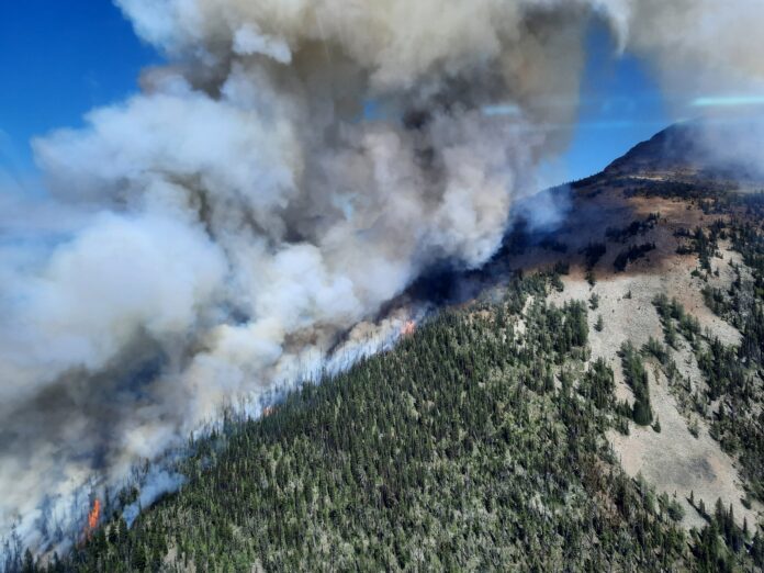
Eight wildfires are active in the East Kootenay, including a new one reported southeast of Kimberley.
BC Wildfire Service officials said the Mount Evans fire was first reported Monday afternoon, about 29 kilometres away from the community.
Officials estimate the fire to be about 20 hectares in size as of Tuesday morning.
“A helicopter reconnaissance flight occurred upon detection, and BC Wildfire Service personnel are currently undertaking response planning,” said Wildfire Service officials. “The fire is burning at a high elevation in steep terrain; and although smoke is highly visible from Kimberley and surrounding communities, it is not currently threatening structures.”
The fire is believed to have been caused by a lightning strike.
Details on the seven other fires in the region can be found below.
Connell Ridge
The fire is estimated to be 1,350 hectares in size, about 23 kilometres south of Cranbrook.
The fire is being attacked by 109 firefighters, 29 pieces of heavy equipment and 11 helicopters.
“There are currently five unit crews, two initial attack crews, two Structure Protection Specialists, an Incident Management Team and other operational and support staff supporting the response,” said officials.
On Monday, crews completed primary containment lines, with both ground and air crews set to burn pockets of fuel between the fire’s perimeter and the containment lines.
Larger aerial ignition operations could happen on Tuesday if conditions allow.
“Operations staff have spent the last several days building a comprehensive plan that outlines the conditions that will provide a window of opportunity to initiate the planned ignition,” said Wildfire Service staff. “As much advanced warning as possible will be provided to the surrounding communities, as there will be an increase in smoke visible.”
Crews and heavy equipment operators are working on additional guard lines around the perimeter to prepare in case the fire crosses the containment lines.
Area restrictions have been implemented around the fire, to keep the public safe and give firefighting crews room to work.
The evacuation alert for six properties south of Mount Baker along Gold Creek Forest Service Road is still in effect.
Cummings Creek
The fire, about five kilometres west of Sparwood, is estimated to be about 45 hectares in size as of Tuesday.
Officials reported aggressive fire behaviour overnight on Tuesday.
This particular wildfire presents some challenges to crews attempting to contain the blaze.
“The fire is continuing to burn in extremely steep, inoperable terrain where it is unsafe for crews or equipment to work on suppression operations or build containment lines,” said officials. “The access to the fire is limited, partly because of steep terrain and partly due to the smoky conditions that limit air access.”
That said, air crews may begin dumping water on the northern side of the fire if conditions allow.
BC Wildfire Service officials said fire apparatus, structure protection unit trailers and personnel began moving into Sparwood on Monday as a precautionary measure.
They said Sparwood is not under an immediate threat, but officials want to make sure the community is as safe as possible should the Cumming Creek fire move any closer.
An info session is planned for Tuesday evening at the Sparwood Recreation and Leisure Centre.
Residents will have the opportunity to learn more about the fire and BC Wildfire Service’s response to it.
Doors open at 8 p.m., with a Q&A session set for 8:45.
Weasel Creek
The cross-border fire started in Montana on July 30th before coming into B.C. on Aug. 4th.
648 hectares of the 1,241-hectare fire is on the northern side of the border, in the Flathead Valley, about 40 kilometres south of Baynes Lake.
U.S. and Canadian firefighting teams are working across the border on a management strategy and sharing resources as needed.
Out-of-control fires
- Gilnockie Provincial Park – The fire was first reported on Aug. 4th, east of Yahk and is believed to be caused by a lightning strike. The fire is currently 1.3 hectares.
- Mount Docking – The nearly 20-hectare fire was started by a lightning strike on July 30th. The fire is burning in the mountains east of Radium Hot Springs.
- Mount Nicholas – A 2.1-hectare blaze burning in the wilderness northeast of Wasa. Wildfire officials first discovered the lightning-caused fire was first discovered on Aug. 6th.
- Stair Lakes – The 44-hectare wildfire northwest of Kimberley was first discovered on July 31st. Firefighting officials said the fire was likely caused by a lightning strike.


