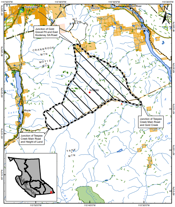
Public access has been limited in the area around the Connell Ridge wildfire, about 15 kilometres south of Cranbrook.
This comes with an area restriction implemented by the BC Wildfire Service (BCWS) on Thursday.
“This area restriction reflects the continued need to protect the public in areas where ongoing fire suppression activities are taking place,” said BCWS officials.
The restriction will be in place until Oct 15., or when it gets rescinded.
The only people allowed in the zone are those with a signed authorization form, people travelling to or from their property as long as it is not under an evacuation order, people travelling in an official capacity or firefighters and other support staff.
Anyone found in violation of the area restriction may be fined $1,150.
As of Thursday evening, the Connel Ridge wildfire is estimated to be 1,143 hectares.
Six properties south of Mount Baker along Gold Creek Forest Service Road are still on an evacuation alert due to the fire.
You can see the area impacted on the map at the bottom of this article.