Firefighters working to push back wildfires received a helping hand from mother nature with the weekend’s rain.
Meanwhile, the Evacuation Alert for the Cultus Creek wildfire has been lifted by the Regional District of Central Kootenay (RDCK). The Alert was originally issued on July 16th for properties south of Next Creek to the north of Midge Creek.
“The RDCK advises people to remain vigilant in the event that conditions change and an Evacuation Alert or Order may be re-issued and the evacuation process will recommence. It is recommended to prepare an emergency kit and ensure preparedness, including moving pets and livestock to a safe area, in the event of another emergency,” said RDCK officials.
Rains have helped contain the Akokli Creek wildfire on the east shore of Kootenay Lake as well. The fire, 7 kilometres away from Boswell, has grown to about 3,140 hectares in size since its discovery on July 9th.
“Fire activity has remained largely stable and rain is keeping fire behaviour low. Yesterday in advance of forecasted rain, crews conducted small-scale hand ignition operations to reinforce the control lines on the northwest flank towards Lockhart Park,” said BCWS officials.
The RDCK has also reduced the area of the Evacuation Alert to 81 properties from Lockhart Beach Provincial Park south to include 12490 Highway 3A in response to the Akokli Creek fire.
Over at the 2,990-hectare Bill Nye Mountain fire, more than 10 millimetres of rain and high humidity on Sunday has made the flames less aggressive and bolstered the work of firefighters.
“Crews continue to action hot spots found by drone scan and mop up is ongoing on the northeast flank. With a considerable amount of rain taken in the area, the incredibly steep and wet terrain is being evaluated for where crews and resources can work safely in the new conditions. Nearly half of the fire perimeter has been wrapped with either machine guard, hand-built fuel-free or hose lay,” said officials with the B.C. Wildfire Service (BCWS).
As of Sunday afternoon, 54 firefighters, two pieces of heavy equipment and one helicopter were responding to the fire.
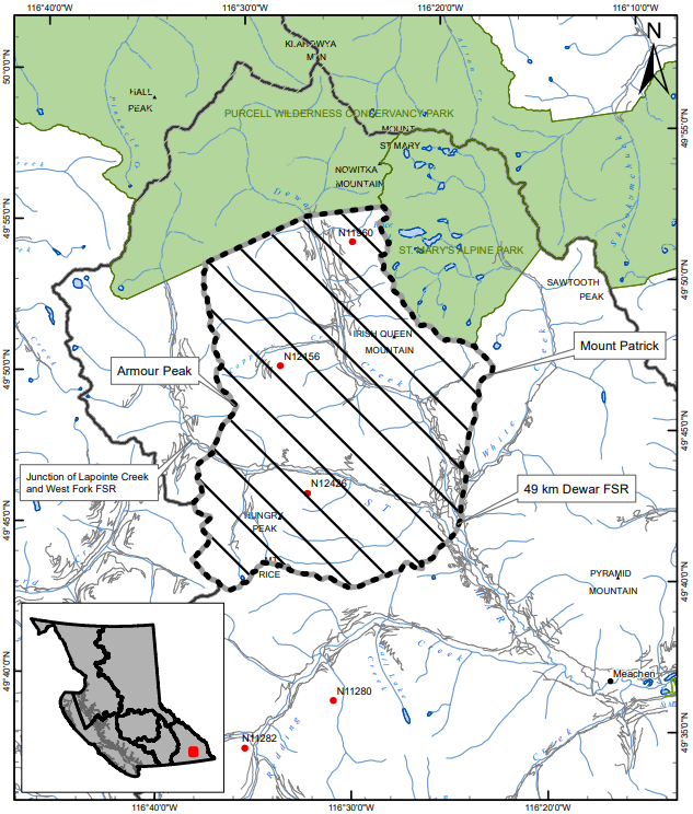
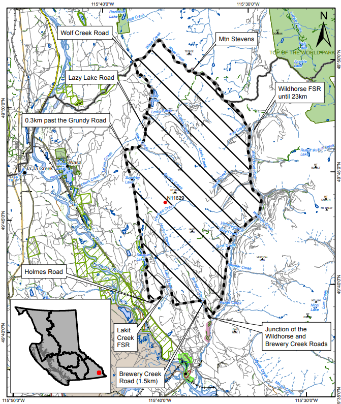
While the rain did offer some assistance, area restrictions around the Bill Nye Mountain and Dewar Creek fires have both been increased.
The Dewar Creek fire, about 36 kilometres northeast of Kimberley, was first discovered on July 16th and has since grown to an estimated 152 hectares.
Updated maps can be found at the end of this article.
Rains have helped contain the Akokli Creek wildfire on the east shore of Kootenay Lake as well. The fire, 7 kilometres away from Boswell, has grown to about 3,140 hectares in size since its discovery on July 9th.
“Fire activity has remained largely stable and rain is keeping fire behaviour low. Yesterday in advance of forecasted rain, crews conducted small-scale hand ignition operations to reinforce the control lines on the northwest flank towards Lockhart Park,” said BCWS officials.
As of Mondy morning, 15 wildfires are active across the East Kootenay and Creston Valley, 11 of which are out of control.
More: BCWS dashboard