The Tanglefoot, Ptarmigan and Dewar Creek wildfires now have area restrictions around them to protect the public where fire suppression work is taking place.
The area restriction means that the public will only be able to enter and exit the vicinity for specific reasons, such as using the highway, travelling to and from your home, as long it is not under an evacuation order, or if you are helping firefighting efforts.
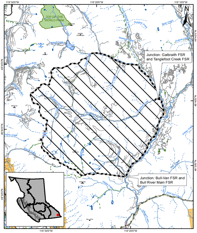
The Tanglefoot Creek wildfire is estimated to be 195 hectares in size, about 30 kilometres northeast of Cranbrook. The area restriction covers the areas outlined by the map below. Access along Bull River Main Forest Service Road (FSR), Bull Van FSR and Galbraith FSR is still permitted.
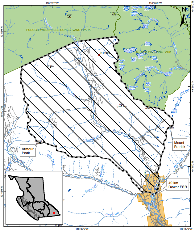
A 42-hectare fire in the Dewar Creek area, about 36 kilometres northwest of Kimberley, is continuing to burn out of control after it was discovered on Friday. The area restriction around that fire stretches from Purcell Wilderness Conservancy Park in the north to White Creek in the south.
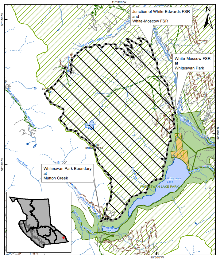
In the Ptarmigan Creek area, north of Whiteswan Lake and about 23 kilometres northwest of Canal Flats, an 18-hectare fire is active and out of control. The restricted area borders the park surrounding Whiteswan Lake and covers the area north to Moscow Creek. According to the BC Wildfire Service, access to Whiteswan Provincial Park and travel on the Moscow FSR is allowed, but travel along Edwards FSR is not.